The most persistent error we see in Bay Area hillside construction is treating every slope like a textbook problem. San Francisco’s geology doesn’t read textbooks. A cut on Twin Peaks behaves nothing like an excavation in the Marina, yet contractors routinely apply the same benching angles across sites sitting on completely different formations. The Franciscan Complex underlying much of the city is a tectonic mélange—chaotic blocks of greywacke, shale, and serpentinite sheared together over millions of years—and its strength parameters vary dramatically within a single block. Before any retaining design or foundation layout, we run site-specific slope stability analysis incorporating pore pressure conditions measured during the rainy season, when December through February storms saturate near-surface soils and trigger shallow failures that surprise unprepared builders. For deeper profiles or liquefiable lenses near Lake Merced, we often pair the analysis with a CPT test to capture continuous stratigraphy without sample disturbance.
A factor of safety of 1.5 doesn’t mean much if the pore pressure assumptions don’t match winter groundwater levels measured on site.
Scope of work in San Francisco
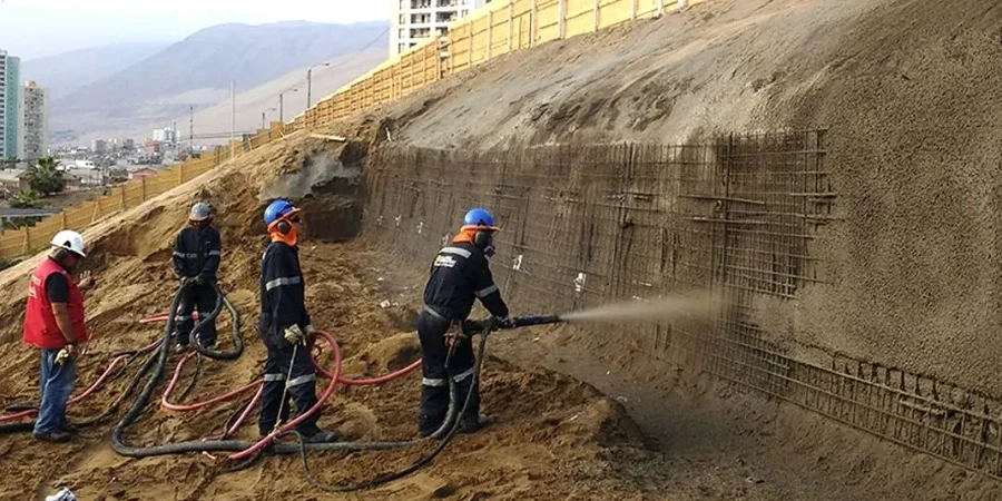
Field demonstration
Critical ground factors in San Francisco
San Francisco sits at 37.77°N, directly astride the San Andreas Fault system, and the last major rupture on the Hayward Fault was in 1868—over 155 years of accumulated strain. The USGS gives a 72% probability of a M≥6.7 event in the Bay Area before 2043. For slope stability, this isn’t abstract seismology; it’s a design condition. The 1989 Loma Prieta earthquake triggered landslides in the Santa Cruz Mountains but also caused fill failures in the Marina District, where artificial fills over bay mud amplified ground motion and lost strength. We factor this history into every San Francisco slope analysis by modeling both the contractive behavior of loose sands and the cyclic softening of saturated lean clays, using Seed-Idriss simplified procedures where applicable. Hillside lots on serpentinite—California’s state rock, abundant in the Presidio and Hunters Point—present an additional challenge because the mineralogy weathers to weak, slickensided surfaces that can fail at angles far lower than standard friction angles would predict. Ignoring this lithology-specific behavior is how slopes that look stable on paper become active landslides during construction.
Our services
Every hillside site in San Francisco presents a different set of boundary conditions, and our stability analysis is structured to match that variability with the right investigation tools.
Limit Equilibrium Modeling with Site-Specific Parameters
We don’t use textbook friction angles. Triaxial CIU and CID tests on undisturbed San Francisco samples feed directly into SLOPE/W or Slide2 models, with groundwater surfaces calibrated to wet-season monitoring data from piezometers installed on your lot.
Seismic Slope Stability Assessment
Pseudostatic and Newmark displacement analyses using ASCE 7-22 ground motion parameters for the site’s specific latitude and longitude. We calculate permanent deformation estimates so the structural engineer can decide whether the foundation can tolerate predicted slope movement.
Post-Storm and Construction-Phase Monitoring Correlation
When we install slope inclinometers or piezometers during the rainy season, we correlate real-time deformation and pore pressure data back to the stability model, allowing the contractor to adjust excavation sequencing before problems develop.
Top questions
What does a slope stability analysis for a San Francisco hillside lot typically cost?
The total investigation and analysis runs between US$1,300 and US$4,540, depending on the number of boreholes, laboratory tests required, and the complexity of the failure surface geometry. A straightforward static analysis on a single-family lot with one boring and basic triaxial testing falls toward the lower end. Sites near serpentinite outcrops or requiring seismic displacement analysis and multiple cross-sections will approach the upper end of that range.
How long does the slope stability study take from field work to final report?
A typical timeline is three to four weeks. The field investigation—drilling, sampling, and piezometer installation—occupies the first week. Laboratory triaxial and index testing requires two weeks for CIU specimens to reach saturation and shear at controlled strain rates. The final week covers limit equilibrium modeling, seismic analysis, and report drafting with our geotechnical stamp.
Which analysis method do you use for slopes with non-circular failure surfaces?
For slopes underlain by Franciscan Complex bedrock, failure surfaces often follow pre-existing shear planes or bedding contacts rather than circular arcs. We apply the Morgenstern-Price method with non-circular search algorithms in Slide2, and for slopes with significant strength contrast between colluvium and bedrock, we run Spencer’s method as a verification because it satisfies both force and moment equilibrium without assuming a circular geometry.
Does San Francisco require a slope stability report for building permits on hillside lots?
Yes. The San Francisco Building Code, which adopts the IBC with local amendments, mandates geotechnical investigation for any structure on a slope steeper than 3:1 (horizontal:vertical) or where the planned excavation exceeds 5 feet in depth within a zone of potential instability. The Department of Building Inspection reviews the report for minimum factor of safety compliance before issuing the permit. More info.